About Earth Aid
EARTH-AID develops a next-generation, AI-driven decision support system for geohazards and georesources within the Destination Earth ecosystem. By integrating Earth science, artificial intelligence, high-performance computing, and social science perspectives, the project advances the state of the art in geohazard impact assessment.
It adopts a community-driven, transparent, and evidence-based approach, grounded in open access principles. Quality assurance, ethics, and trustworthiness are embedded throughout the project, with user communities engaged from the outset and involved at every stage of development.
The project is funded by the European Commission under the HORIZON EUROPE 1.3 - Research infrastructures (HORIZON-INFRA-2025-01 – TECH-03) programme.
Duration: September 2026 – September 2029
Destination Earth
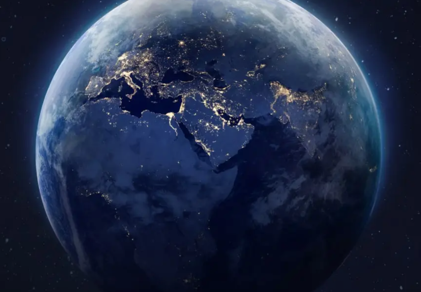
Destination Earth is a flagship initiative of the European Commission to develop a highly accurate digital model of the Earth (a digital twin of the Earth).
Read more: https://destination-earth.eu/destination-earth/
What we do
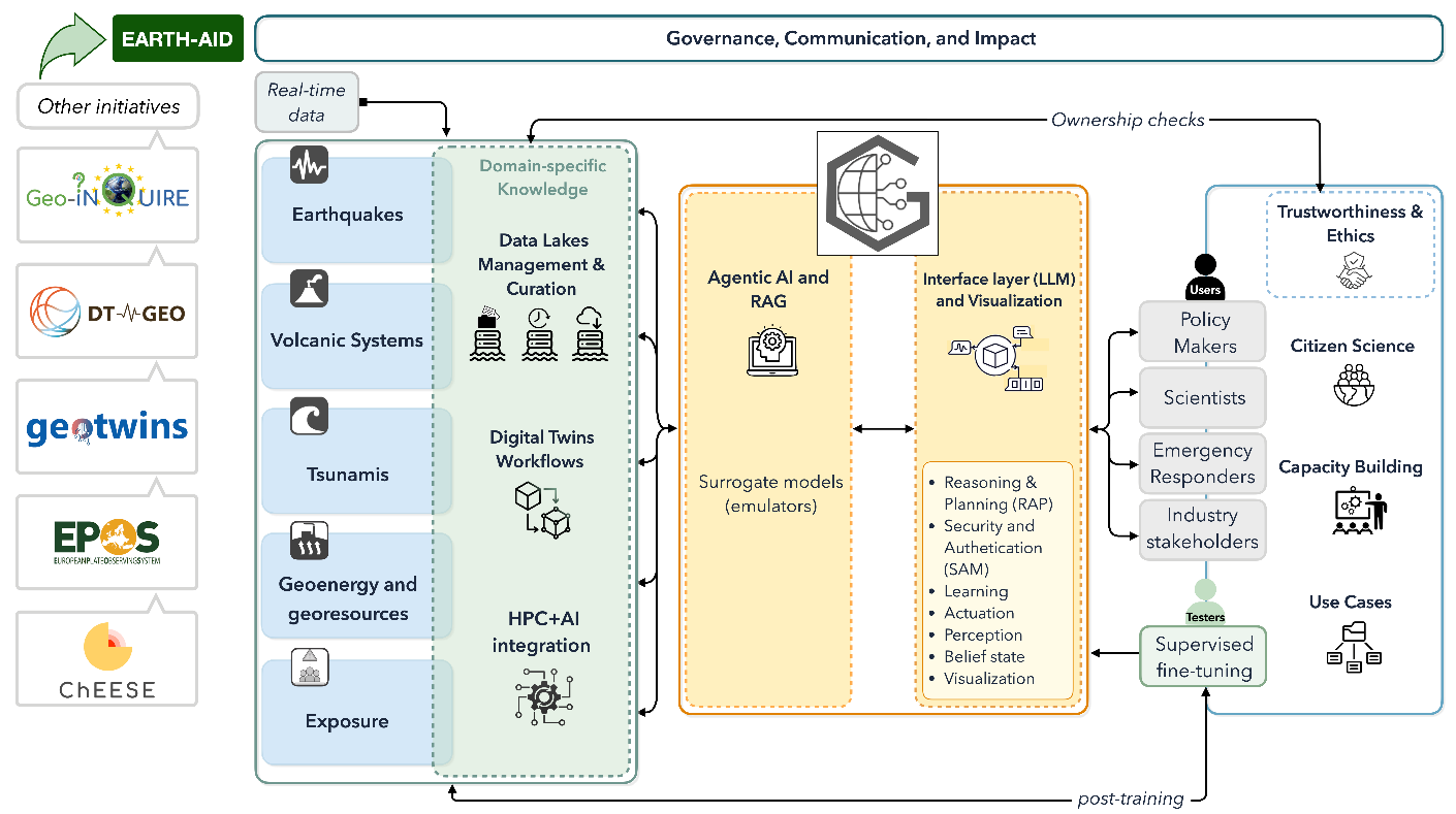
EARTH-AID develops GEODE, an explainable AI system that enables rapid and trustworthy impact assessments for geohazards and georesources within the Destination Earth (DestinE) ecosystem.
GEODE combines Digital Twins, federated data, real-time observations, curated knowledge, and artificial intelligence to generate transparent, uncertainty-aware impact assessments. By integrating physics-based simulations with AI-driven reasoning, GEODE supports decision-making across multiple hazards and time scales—from rapid emergency response to long-term planning and “what-if” scenario exploration.
Designed for both experts and non-experts, GEODE transforms natural-language questions into locally tailored analyses, interactive maps, and actionable insights. The system is co-developed with scientists, civil protection authorities, and industry partners to ensure operational relevance.
Building on European initiatives such as DT-GEO, GeoTwins, EPOS, and EuroHPC, EARTH-AID enables scalable, interoperable, and trustworthy AI solutions for improved geohazard preparedness and resilience across Europe.
Why it matters
Digital Twins for geohazards and georesources have great potential to support better planning and decision-making. However, their operational use remains challenging due to high computational demands, specialised expertise requirements, and the complexity of integrating diverse real-time data sources.
EARTH-AID addresses these challenges by developing an AI-enabled layer on top of Digital Twins that can:
-
rapidly analyse large and complex datasets,
-
integrate heterogeneous real-time information,
-
provide accessible and trustworthy impact assessments.
This enables a shift from reactive response towards anticipatory risk management, helping communities and decision-makers better prepare for future hazards across Europe’s most exposed regions.
Who benefits
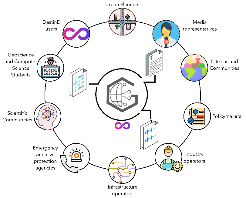
EARTH-AID supports policy makers, researchers, emergency responders, infrastructure operators, and industry stakeholders by providing better access to timely, transparent, and actionable information.
By improving understanding of potential impacts before, during, and after hazardous events, GEODE contributes to stronger preparedness, reduced risks, and increased resilience across Europe.